説明
Feature:
1. SENSITIVE RECEPTION: Land meter use a measurement grade high sensitivity gnss receiver chip and use a six star system for global coverage
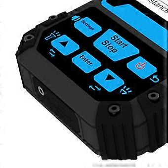
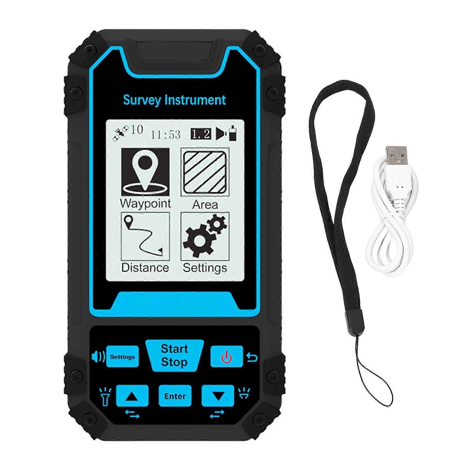
2. MULTIPLE FUNCTIONS: Land meter supports two measurement modes: area measurement(common area) and distance measurement(common distance); Support waypoint acquisition, waypoint navigation, route navigation, trail navigation, lofting navigation; Support data export
3. HIGH ACCURACY: The land survey meter has a high area measurement accuracy, and the signals are good and easy to search for stars. The outdoor place without mobile phone signals can also ensure the use of accuracy
4. LONG LASTING WITH VOICE: Land measure meter adopts industrial three prevention technology, water proof, dusts proof and fall resistant, which is long lasting. With real voice broadcasting(English) and large volume warning, noisy environment can be heard clearly
5. DATA RECORDING: Real time view of trail graphics in use, after saving, you can also view graphics in the record; The land surveyor area measurement tool has built in barometer elevation measurement for more accurate height measurement
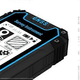
6. CLEAR DISPLAY: The land measuring instrument has a large 2.4in black and white screen, simple and generous, clear to read in the sun. Big button, simple operating is not complicated, easy to get started
Specification:
Item Type: Land Meter
Location Time: Hot Start Time: 1 Second; Cold Start Time: 30 Seconds
Position Accuracy: Within 2 meters (HDOP value less than 1.0)
Area Accuracy: Measurement error not greater than 0.03μm (1-3μm), 2% (greater than 3μm)
Distance Accuracy: Within one meter (when HDOP value is less than 1.0, measurement length is 100 meters)
Features: Coordinate measurement, route editing, trail recording, navigation function, height measurement, area measurement, distance measurement, elevation function
Data Statistics: Area statistics, distance statistics
Area Records: 99 Waypoint records 2000
Distance Records: 99 Trail records 100
Route Records: Maximum version number of 200, up to 400 points per route
Trail Display: Real time trail display during measurement, can also view past measurement data in statistics records
Barometric Height Measurement: Approximately 1 meter (barometric measurement, absolute height calibration required); Approximately 10 meters (GPS measurement, HDOP value less than 1.0)
HDOP Setting: User defined HDOP Setting
Display Screen: 2.4in outdoor high definition black and white screen
Operating Temperature: -20 degrees Celsius to 65 degrees Celsius
Storage Temperature: 40 degrees Celsius to 75 degrees Celsius
Data Interface: USB interface, can be charged through this interface
Data Export: Yes
Battery: 1 x 3.7V li ion battery 1800mAh.
Package List:
1 x Land Area Measurement Instrument
1 x Lanyard
1 x USB Cable
1 x User Manual
-
ブランド:
Unbranded
-
カテゴリー:
露出計
-
Fruugo ID:
379704955-819366629
-
EAN:
7792467048062
製品安全情報
以下に概説するこの製品に固有の製品安全性情報を参照してください。
以下の情報は、この製品を販売する独立したサードパーティ小売業者によって提供されています。
製品安全ラベル

安全上の警告:
Warning: Please read the product instructions carefully before use to ensure correct use.
シリアルナンバー:
7792467048062