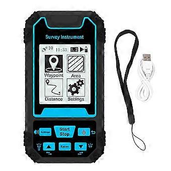
Land Meter Mini Portable Handheld Surveyor Area Measurement Tool GNSS 2.4in Screen Measuring Instrument S8
- ブランド: Unbranded


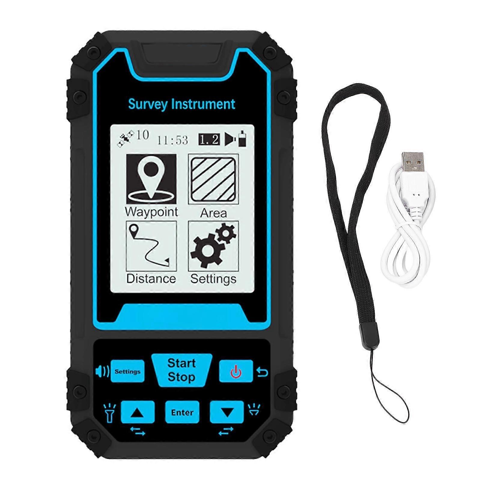
Land Meter Mini Portable Handheld Surveyor Area Measurement Tool GNSS 2.4in Screen Measuring Instrument S8
- ブランド: Unbranded
| 希望小売価格: | |
| 価格: | |
| 得する金額: | ¥6,200 (22%) |
在庫あり
以下の支払い方法を利用することができます
説明
- ブランド: Unbranded
- カテゴリー: プリズム
- Fruugo ID: 416482686-878825848
- EAN: 7540131350498
製品安全情報
以下に概説するこの製品に固有の製品安全性情報を参照してください。
以下の情報は、この製品を販売する独立したサードパーティ小売業者によって提供されています。
製品安全ラベル

配送と返品
2日間以内に発送
-
STANDARD: 無料 - 間の配達 木 04 12月 2025–木 11 12月 2025 - 無料
中国より発送。
ご注文の商品は、お客様の仕様に従い、万全の状態で配送されるように最善を尽くしています。しかし、もし注文に抜けがあったり、注文したものと違う商品が届いたり、注文に満足できないその他の理由がある場合は、注文全体やその中のいずれかの商品を返品し、その全額の返金を受けることができます。 全額返金ポリシーを見る
製品コンプライアンスの詳細
以下に概説されているこの製品に固有のコンプライアンス情報を参照してください。
以下の情報は、この製品を販売する独立したサードパーティ小売業者によって提供されています。
製造業者:
次の情報は、Fruugoで販売される関連製品の製造業者の連絡先詳細です。
- Wuhan Pinsheng Technology Co., Ltd.
- Wuhan Pinsheng Technology Co., Ltd.
- No.A357,Shoulder-to-shoulder?Incubator,Building?4
- Wuchang District
- Wuhan
- CN
- 430000
- pinsenkj@163.com
- 18062524796
- https://shop01473o1711614.1688.com/page/creditdetail.htm?spm=a261y.7663282.shopNavigation.1.6310755czE9SFQ
EUにおける責任者:
次の情報は、EUにおける責任者の連絡先情報の概要です。ここで言う責任者とはEUに拠点を置く指定経済事業者で、EU域内で販売される関連製品に関するコンプライアンス義務を負う者のことです。
- None
- Kequ Technology s.r.o.
- Pražákova 1008/69
- Štýřice
- Jihomoravský kraj
- Brno
- CZ
- 63900
- christopher25106@outlook.com
- 420608214795