説明
Feature:
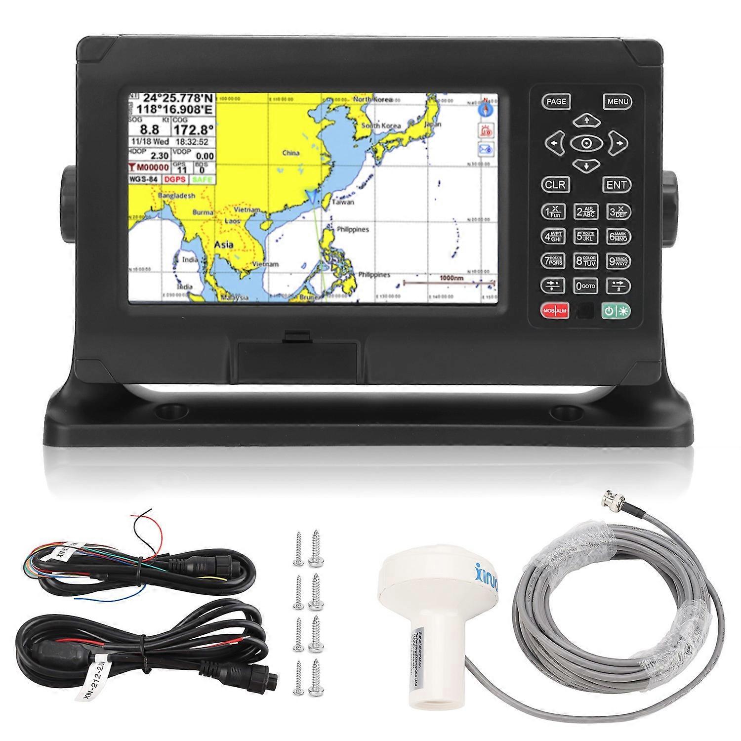
1. LCD Display: 8 inch color TFT LCD display, 800×480 resolution, high brightness, wide viewing angle, supports custom data names, sign styles, and colors.
2. Dual Mode Positioning: Built in high accuracy BDS and GPS dual mode positioning, high sensitivity, anti interference, stable, make the position, speed and heading information more precise.
3. Picture Mode: Different display modes can be selected, including standard chart, full screen chart, simple chart, satellite ephemeris, 3D navigation, and other user interfaces.
4. Premium Material: Chartplotter is made of premium ABS material, IP65 water resistant, dust proof, fast heat dissipation, sturdy and high durability, have a long service time.
5. Storage Capacity: The flash chip with large capacity and high speed and stability supports storage of 50000 waypoints, 50000 marker points, 500 routes, 200 points for one route, 1000 tracks and 1.6 million track points.
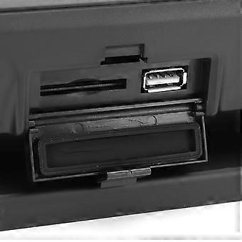
6. WiFi: Bid farewell to the traditional way, enjoy networking services, built in WiFi module, support online software upgrade, integration of Internet of Things technology, support function expansion, help smart shipping.
Specification:
Item Type: Chartplotter
Material: ABS
Screen Type: Color TFT LCD Display
Screen Size: 8 inches
Resolution: 800 x 480
Screen Brightness: 400cd/㎡
Languages: English
Picture Mode: Standard chart, simple chart, full screen chart, navigation data, satellite ephemeris, 3D navigation
Storage Capacity: 50000 waypoints, 50000 mark points, 500 routes, 200 points per route, 1000 tracks, 1.6 million track points
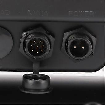
Interface: 2 way NMEA0183 output, 2 way NMEA0183 input (independent of each other, baud rate can be set independently)
WIFI: 802.11 b/g/n
Power Consumption: Less than 8W (voltage 24V)
Working Temperature: -15℃ to +55℃
Storage Temperature: -20℃ to +60℃
Waterproof Grade: IP65
GNSS
Receive Channel: 72 channels
Receiving Frequency Band: GPS L1: 1575.42MHz; BDS B1: 1561.098MHz
Positioning Accuracy:
GPS and BDS 2.5m (CEP50%, open field)
GPS: 5m (CEP50%, open area)
BDS: 5m (CEP50%, open area)
Speed measurement Accuracy: 0.1m/s (50% at 10m/s)
First Positioning Time: Less than 30 seconds (cold start), less than 1 second (warm start)
Meeting Standards: IMO A.694(17) , IMO MSC 112(73), IEC 61108-1, IEC 61162-1, IEC 60945
Introduction:
1.8in color LCD screen, 800×480 resolution, high brightness, wide viewing angle.
2. Support the display of various chart data such as for C MAP (MAXIMUM).
3. Classic mode and practical mode dual operating system.
4. Built in BDS, GPS dual mode high accuracy positioning module, the positioning accuracy is stable.
5. Multi screen display mode for users to choose and switch freely.
6. Support network connection to realize online software upgrade.
7. Advanced intelligent voice technology, intelligent broadcast operating content, alarm content, etc..
Package List:
1 x
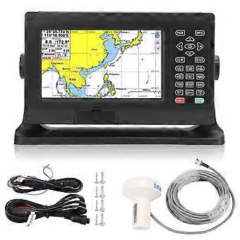
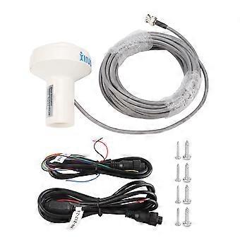
Chartplotter1 x GNSS Antenna1 x 8 Core Data Cable1 x 2 Core Power Cord1 x Mounting Base Bracket2 x Fixed Knob(with 2 Rubber Mat)4 x Base Fixing Screws4 x Small Screw1 x User Manual
Note:
The product has passed CE certification and CCS type approval.
-
Fruugo ID:
435080493-912682577
-
EAN:
7409249365940